SERVICES  Crystal River Jeep Tours
Jeep Tours...
Location and History...
Picture Page...
Return to Home Page...
 
 Marble, Colorado


HIKING

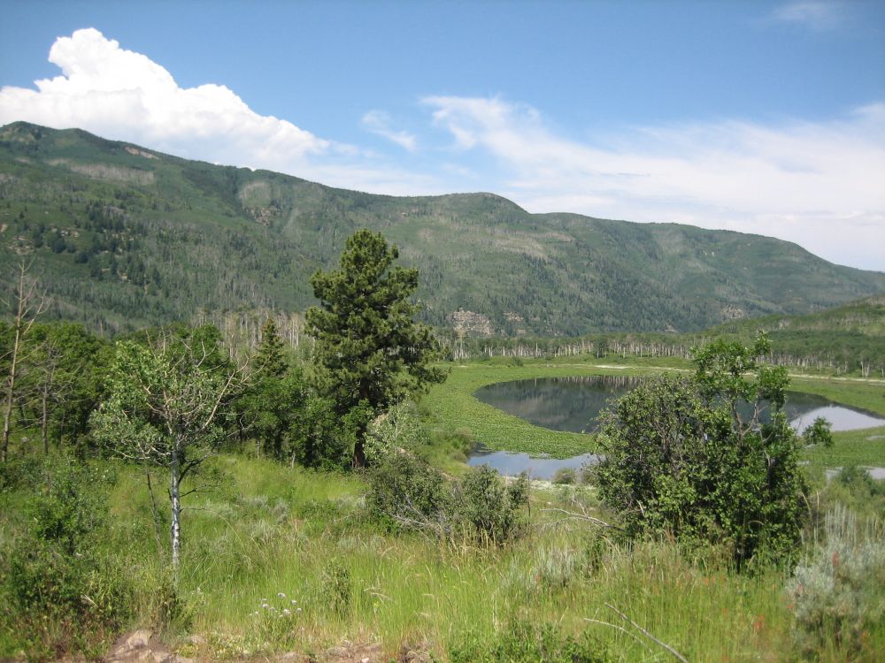
Most of the links below are from the USFS White River National Forest, Aspen-Sopris Ranger District trails index. Beginning in September be cautious of hunters along any of these trails. Wear highly visible clothing, such as a red/orange vest. Most of these trails interconnect in the wilderness areas.

The following trails can be accessed by car as you drive from Carbondale to Marble via Hwy 133 and CR3. Don't forget to stop by Penny Hot Springs on your way.

Avalanche Creek Trail: The trail head is near the Avalanche Campground at the end of the dirt road. A low clearance car is probably not a good idea. This trail connects with Lost Trail and Arkansas Mountain Trail in the Maroon Bells/Snowmass Wilderness.
Lily Lake Trail: The Lily Lake trail head is in Redstone. You can also access Lily Lake from the Placita Trail.
Placita Trail: Watch for the trail head sign between Redstone and the Marble turn off, as Hwy 133 crosses the Crystal River. Park there and hike, or take the one lane road a short distance to the trail head. Again, a low clearance vehicle is probably a bad idea.
Carbonate Creek Trail: You'll find the trail head parking in Marble near the Beaver Lake Lodge. Look for the trail head sign near the stop sign (one of two in town).
 

These trail heads are accessable by car from the Quarry Road south of Marble. Be cautious on the Quarry Road. If the big white Yule Marble Quarry truck is coming down find a wide spot quick. He will take the inside lane, you MUST stop on the outside. He may have 50 tons of marble on the back. These trails interconnect and take you into the Raggeds Wilderness.

Raspberry Creek Loop Trail: The trail head is about 1/2 mile from the bridge. Parking and sign on the right. This trail connects with Anthracite Pass Trail.
Anthracite Pass Trail: The trail head and parking is about 4 miles from the bridge, about 1/4 mile before the Yule Marble Quarry. Anthracite Pass Trail connects with Yule Creek and Raspberry Creek trails.
Yule Creek Trail: The Yule Creek trail junctions off the Anthracite Pass trail. Little known fact -- you can get to the upper portal of the quarry from this trail.


A series of trails can be accessed from the Lost Trail/Lead King Basin road. Many of these trails are interconnected in the Maroon Bells/Snowmass Wilderness. Getting to the trail heads requires a FWD vehicle, or reserve a drop off/pick up with Crystal River Jeep Tours.

North Lost Trail: The trail head is about 2 miles from the Goldpan Gallery. An Outback or other higher clearance vehicle can make it. Take the left fork at the top of Daniels Hill. Lost Trail connects with Avalanche Trail, Carbonate Trail and Arkansas Mountain Trail.
Silver Creek Pass Trail: The trail head is at the summit of the Lost Trail/Lead King Road, about 4 miles from the Goldpan Gallery. Take the left fork at the top of Daniels Hill. It's not safe nor prudent to take anything other than a high clearance FWD to get there. Silver Creek Trail connects with Arkansas Mountain Trail and Capital Peak. Here's a view from the trail head parking.
Arkansas Mountain Trail: This trail connects Silver Creek Trail to Avalanche Trail.
Geneva Lake Trail: The trail head is in Lead King Basin about 6 miles from the Gold Pan Gallery. Take the left fork at the top of Daniels Hill. You could take the right fork via Crystal City to get there, but the road is very much rougher. Either way it's not safe nor prudent to take anything other than a high clearance FWD to get there. Or contact Crystal River Jeep Tours for a drop off/pick up. Rumor has it that Geneva Lake is where the big fish are. The trick is to get them to bite. The Forest Service stocks Geneva Lake by backpacking fingerlings.

The trails listed below are all accessed in one degree or another from the Geneva Lake trail head.
 
Trail Rider Pass: See Geneva Lake Trail and North Fork Cutoff Trail. Trail Rider Pass connects Geneva Lake and Snowmass Lake.
North Fork Trail: Begins at the Geneva Lake trail head, follows the north fork of the Crystal River and connects with Frigid Air Pass, Hasley and Fravert Basins. Horses use this one quite often. Please give horses the right-of-way to prevent erosion near the trails.
North Fork Cutoff Trail: This trail starts at the junction with the North Fork Trail and winds with the junction to the trail which connects with Geneva Lake and continues over Trail Rider Pass. It has a nice view of the north fork of the Crystal River Valley and Lead King Basin. It is a short cut for travelers going to Snowmass Lake, but it is very steep. The trail is heavily used by horses and backpackers. Please give horses the right-of-way to prevent erosion near the trails.
Fravert Basin: Accessed from the North Fork Trail and part of a loop trail connecting West Maroon Pass and Snowmass Lake. Loves Cabin is where Outwest Guides establishes one of their wilderness camps every year.
Hasley Basin: Accessed from the North Fork Trail and part of a loop trail connecting West Maroon Pass and Snowmass Lake. This trail is often used by hikers going over West Maroon Pass and on to Geneva Lake and/or Snowmass Lake. It is a fairly steep trail most of the way, especially over the saddle connecting the East Fork drainage and Hasley Basin.
Buckskin Pass: See West Maroon Pass and Four Pass Loop.
East Fork/West Maroon Pass: The trail head is in Schofield Park. Access is easiest via Crested Butte over Schofield Pass. From Marble you have to negotiate the Devils Punchbowl to get there. This trail is heavily used by hikers going from Aspen to Crested Butte. This trail connects with Hasley Basin, Frigid Air Pass and West Maroon Pass. There are breath-taking views at the passes and beautiful meadows filled with wild flowers.
Four Pass Loop -- West Maroon to Buckskin: An ambitious backpacking trip located in the beautiful Maroon Bells/Snowmass Wilderness that is routed over four mountain passes (West Maroon - 12,500 ft.; Frigid Air - 12,415 ft.; Trail Rider - 12,420 ft.; Buckskin - 12,500 ft.). The variety of terrain encompasses scenic forests, mid to late summer wildflowers, challenging river crossings, and provides spectacular views of the Maroon Bells and numerous other peaks of the Elk Mountain Range.


Copyright © 2010.
Crystal River Jeep Tours
Marble, Colorado 81623

PUC ORC00214

"This business operates on the White River National Forest and is under a Special Use Permit with the Forest Service, U.S.D.A."

Valid HTML 4.01 Transitional